* Astronomy

Members Login
Username 
 
Password 
    Remember Me  
Post Info
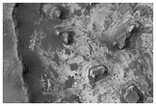
TOPIC: Mars Reconnaissance orbiter


L

Posts: 131433
Date:
RE: Mars Reconnaissance orbiter
Permalink  


New images for 8 November 2007

Wallpaper (ZIP):800x600 1024x768 1152x864 1280x960 1600x1200 1920x1440 2048x1536
iPHONE 320x480


HiRISE at One Year: Student Image of the Week-Seasonal Changes of South Polar Dark Dune Field
HiRISE at One Year: Student Image of the Week-Seasonal Changes of South Polar Dark Dune Field (PSP_003609_1110)
Gullies and Concentric Fill in an Unnamed Rampart Crater in Noachis Terra
Gullies and Concentric Fill in an Unnamed Rampart Crater in Noachis Terra (PSP_003708_1335)
Basal Exposure of South Polar Layered Deposits
Basal Exposure of South Polar Layered Deposits (PSP_005682_1035)
Rugged Crater Floor in Terra Tyrrhena
Rugged Crater Floor in Terra Tyrrhena (PSP_005710_1555)
Cerberus Fossae Fissures
Cerberus Fossae Fissures (PSP_005720_1885)


One Year of Primary Science Phase Images: 8 November 2007

__________________


L

Posts: 131433
Date:
Permalink  
 

Wallpaper (ZIP):800x600 1024x768 1152x864 1280x960 1600x1200 1920x1440 2048x1536
iPHONE 320x480


Student Image of the Week: Confluence of Nirgal and Uzboi Valles
Student Image of the Week: Confluence of Nirgal and Uzboi Valles (PSP_003565_1495)
Nirgal and Uzboi Valles are two valleys to the north of the Argyre impact basin in the southern hemisphere.
Proposed MSL Site in North Meridiani
Proposed MSL Site in North Meridiani (PSP_005581_1815)
Image of a proposed landing site the Mars Science Laboratory.
Terraced Fan and Valley in Crater
Terraced Fan and Valley in Crater (PSP_005583_1700)
Terraced fans are rare deposits on Mars: they have only been seen in a few dozen locations.
Proposed MSL Site in Ariadnes Colles
Proposed MSL Site in Ariadnes Colles (PSP_005588_1445)
A proposed landing site for the Mars Science Laboratory.
Layered Sediments in Tithonium Chasma
Layered Sediments in Tithonium Chasma (PSP_005703_1750)
Observations drawn from this image will help understand the history of deposition at this location, and can be compared with nearby related rocks.


__________________


L

Posts: 131433
Date:
Permalink  
 

Wallpaper (ZIP):800x600 1024x768 1152x864 1280x960 1600x1200 1920x1440 2048x1536.iPHONE 320x480

Small Impacts at Slope Streak Apexes
Small Impacts at Slope Streak Apexes (PSP_003259_1850)
Basal Exposure of South Polar Layered Deposits
Basal Exposure of South Polar Layered Deposits (PSP_005313_1040)
Low-Order Inverted Streams near Juventae Chasma
Low-Order Inverted Streams near Juventae Chasma (PSP_005346_1755)
Catastrophic Outflow Features in Tharsis Region
Catastrophic Outflow Features in Tharsis Region (PSP_005361_2005)
Crater with Wind Streak
Crater with Wind Streak (PSP_005375_1675)
South Polar Layered Deposits with Surface Modification
South Polar Layered Deposits with Surface Modification (PSP_005381_0870)
Thumbprint Texture on Dark Dunes in Rabe Crater
Thumbprint Texture on Dark Dunes in Rabe Crater (PSP_005514_1360)
Possible Ancient Salt Deposits within Unnamed Crater in Terra Cimmeria
Possible Ancient Salt Deposits within Unnamed Crater in Terra


__________________


L

Posts: 131433
Date:
Permalink  
 

New images for 17 October 2007

Wallpaper (ZIP):
800x600 1024x768 1152x864 1280x960 1600x1200 1920x1440 2048x1536. iPHONE 320x480
FLYOVER MOVIE Nili Fossae Trough 640 x 360, 2MB, 40 sec.


Negative and Positive Relief Valley Feature
Negative and Positive Relief Valley Feature (PSP_005355_2125)
Slope Streaks within an Impact Crater in Terra Sabaea
Slope Streaks within an Impact Crater in Terra Sabaea (PSP_005369_1925)
Scalloped Terrain and Exhumed Crater in Amphitrites Patera
Scalloped Terrain and Exhumed Crater in Amphitrites Patera (PSP_005421_1215)
Graben in Memnonia Region
Graben in Memnonia Region (PSP_005442_1660)
Radiating Dark Slope Streaks
Radiating Dark Slope Streaks (PSP_005514_1925)
Impact Crater Cut by Ganges Chasma
Impact Crater Cut by Ganges Chasma (PSP_005543_1725)


__________________


L

Posts: 131433
Date:
Permalink  
 

New images for 10 October 2007

Wallpaper (ZIP): 1152x864 1024x768 800x600 . iPHONE 320x480
FLYOVER MOVIE Nili Fossae Trough 640 x 360, 2MB, 40 sec.


Layers in Holden Crater
Layers in Holden Crater (PSP_001666_1530)
Evidence For Water and Wind Processes in Gale Crater
Evidence For Water and Wind Processes in Gale Crater (PSP_001752_1750)
MSL Landing Site in Melas Chasma
MSL Landing Site in Melas Chasma (PSP_002828_1700)
Color Image of Nili Fossae Trough, Candidate MSL Landing Site
Color Image of Nili Fossae Trough, Candidate MSL Landing Site (PSP_003086_2015)
Rocky Mesas of Nilosyrtis Mensae Region
Rocky Mesas of Nilosyrtis Mensae Region (PSP_003231_2095)
Layered Bedrock in Candor Chasma
Layered Bedrock in Candor Chasma (PSP_003830_1740)
Layers Exposed in Crater Near Mawrth Vallis
Layers Exposed in Crater Near Mawrth Vallis (PSP_004052_2045)
Colorful Rocks in the Central Peaks of Ritchey Crater
Colorful Rocks in the Central Peaks of Ritchey Crater (PSP_005372_1515)


-- Edited by Blobrana at 03:33, 2007-10-18

__________________


L

Posts: 131433
Date:
Permalink  
 

HiRISE RELEASES COLOUR IMAGES, MOVIE OF PROSPECTIVE LANDING SITES ON MARS
The High Resolution Imaging Science Experiment, or HiRISE, on NASA's Mars Reconnaissance Orbiter has added a new dimension to its views of Mars. The dimension is colour.
The University of Arizona-based HiRISE team today released 143 colour images valuable to researchers studying possible landing sites for NASA's Mars Science Laboratory, a mission to deploy a long-distance rover carrying a deck of sophisticated science instruments on Mars in 2010. The colour images are online at the HiRISE Website, and are available through the Planetary Data System, NASA's space mission data archive.
The powerful HiRISE camera has taken more than 3,500 huge, sharp images released in black-and-white since it began science operations in November 2006. The camera carries 10 red-filter detectors, two blue-green filter detectors and 10 infrared detectors that record different colours.
HiRISE is also releasing a colour movie, scrolling over one potential Mars Science Laboratory landing site in Nili Fossae, at 21 degrees north latitude and 74 degrees east latitude. The animation shows a range of enhanced colours that correspond to what Mars Reconnaissance Orbiter's imaging spectrometer, called CRISM, has determined to be hydrated clay minerals and unaltered volcanic rocks.


Movie (640 x 360, 2MB, 40 sec)

"The clay minerals are especially promising in the search for ancient life on Mars" - UA Professor Alfred S. McEwen, HiRISE principal investigator.

Beginning this week, images will be released in colour as well as black-and-white on the HiRISE Website. The colours are false colour, not the way Mars would look to human eyes. The images are processed to maximize colour differences, a technique useful for analysing landscapes.

"Colour data are proving very useful in interpreting geologic processes and history on Mars. The images we're releasing today include views of some of the most exciting and compositionally diverse areas on the planet. They are really interesting" - Alfred S. McEwen.

In a Herculean effort, HiRISE team members developed computer software that automatically process images from the different colour filters into colour images.

"The technical hurdle has been that the sets of different colour detectors are staggered within the camera focal plane array, and the spacecraft isnt perfectly steady as it operates in space" - Eric Eliason, HiRISE operations manager.

The spacecraft has excellent pointing control thanks to superb engineering, but HiRISE pixels cover an extremely small angular diameter, which gives the camera its ability to sample the surface at 30 centimetres per pixel from 300 kilometres above the surface. The slightest spacecraft motion causes shifts in the camera pointing in unpredictable ways.
There's only a split-second time lag between the time each colour filter records the same spot on Mars as the camera view sweeps over the planet, but that's enough time for spacecraft motion to knock the colours out of register by up to a few pixels.

"You can't just take the different colour images and lay them down on each other adjusting only for the slight time lag and get a sharp picture" - Eric Eliason.

HiRISE software developer Guy McArthur and applied mathematics undergraduate student Sarah Mattson put a lot of work into developing code that now successfully correlates the data from the different detectors. McArthur developed software that automates colour correlation processing at HiROC, the HiRISE Operations Centre at the UA.
Colour is a boon to geologists who have been trying to discriminate different surface materials and their relation to the topography.

"Colour clearly identifies basic material distinctions like dust, sand or rocks, light-toned layered material, and frost or ice" - Eric Eliason.

Colour also helps geologists correlate layers in the Martian terrain. And scientists will be able to combine HiRISE data with CRISM data to make detailed maps of minerals and soil types on the planet.
A single HiRISE image will often be a multigigabyte image that measures 20,000 pixels by 50,000 pixels, which includes a 4,000-by-50, 000-pixel region in three colours. It can take a computer up to three hours to process such an image.
McEwen decided to process images that support selection of the Mars Science Laboratory, or MSL, landing site first.

"The MSL is holding a landing site workshop later this month, so the colour images had to be ready a couple of weeks in advance to be useful" - Alfred S. McEwen.

The colour images released today were taken over or near about 30 proposed landing sites for the 2010 mission.
The UA-led Phoenix Scout Mission to Mars was saved from being launched to a dangerous, boulder-strewn landing site when researchers saw HiRISE images taken soon after the camera began taking science images in late 2006.
Images from HiRISE and from Arizona State University's Thermal Emission Imaging System on Mars Odyssey were used in choosing where the Phoenix spacecraft will land on May 25, 2008.
McEwen said the HiRISE camera will try to image the Phoenix spacecraft landing site again in January, although it could be so cloudy the camera might have to wait an extra month or two for a clear view.

__________________


L

Posts: 131433
Date:
Permalink  
 

New images for 3 October 2007

Wallpaper (ZIP):  1152x864    1024x768    800x600     For iPhone  320x480


Student Image of the Week: Light-Toned Cap Materials in Aram Chaos
Student Image of the Week: Light-Toned Cap Materials in Aram Chaos (PSP_003617_1835)
Circular Feature in South Polar Residual Cap
Circular Feature in South Polar Residual Cap (PSP_005349_0930)
Graben in Memnonia Fossae
Graben in Memnonia Fossae (PSP_005376_1575)
Dust Devils Dancing on Dunes
Dust Devils Dancing on Dunes (PSP_005383_1255)
Channels East of Olympus Mons
Channels East of Olympus Mons (PSP_005401_1960)
Chain of Pits on Arsia Mons
Chain of Pits on Arsia Mons (PSP_005414_1735)
Flow-like Features in Promethei Terra
Flow-like Features in Promethei Terra (PSP_005419_1380)


__________________


L

Posts: 131433
Date:
Permalink  
 

New images for 26 September 2007

Wallpaper (ZIP):  1152x864    1024x768    800x600     For iPhone  320x480

Small Channel Winding between Knobs in the Tartarus Colles
Small Channel Winding between Knobs in the Tartarus Colles (PSP_001420_2045)
Student Image of the Week: Debris Apron South of Euripus Mons
Student Image of the Week: Debris Apron South of Euripus Mons (PSP_003639_1345)
South Pole Residual Cap Swiss-Cheese Terrain Monitoring
South Pole Residual Cap Swiss-Cheese Terrain Monitoring (PSP_004976_0940)
South Pole Residual Cap Swiss-Cheese Terrain Monitoring
South Pole Residual Cap Swiss-Cheese Terrain Monitoring (PSP_005095_0935)
Transected Wrinkle Ridge in Ophir Chasma
Transected Wrinkle Ridge in Ophir Chasma (PSP_005330_1275)
Small Rayed Crater
Small Rayed Crater (PSP_005336_1620)


__________________


L

Posts: 131433
Date:
Permalink  
 

NASA's Mars Reconnaissance Orbiter is examining several features on Mars that address the role of water at different times in Martian history.
Features examined with the orbiter's advanced instruments include material deposited in two gullies within the past eight years, polar ice layers formed in the recent geologic past, and signs of water released by large impacts when Mars was older.

Read more  

Mars Reconnaissance Orbiter Images


Gullies with Characteristics of Water-Carved Channels
False-color image of gully channels in a crater in the southern highlands of Mars, taken by the High Resolution Imaging Science Experiment camera on the Mars Reconnaissance Orbiter.
+ Full image and caption
  False-color image of gully channels on Mars
Layered Ice Deposits near North Pole of Mars
This false-color image of the north polar layered deposits has been processed to emphasize color variations.
+ Full image and caption
  false-color image of the north polar layered deposits
Lava-Draped Channel System on Mars
This image shows a portion of the Athabasca Valles channel system. Part of a streamlined "island" is visible on the right, and dune-like landforms that occur on the channel floor can be seen on the left.
+ Full image and caption
  This image shows a portion of the Athabasca Valles channel system. Part of a streamlined
Video Exploration of Details in Martian North Polar Layered Deposits
This video provides zoom and pan moves to emphasize the context and features of layered deposits near the north pole of Mars.
+ Video and full caption
  Martian North Polar Layered Deposits
Simulated Flight over Gullied Crater
This video uses three-dimensional modeling of a gullied crater in the Centauri Montes region of Mars and simulates a flight over that landscape.
+ Video and full caption
  Simulated Flight over Gullied Crater
Video Exploration of Details in Athabasca Valles on Mars
This video provides zoom and pan moves to emphasize the context and features of a Martian valley named Athabasca Valles, perhaps the youngest outflow channel on Mars.
+ Video and full caption


  Athabasca Valles on Mars


__________________


L

Posts: 131433
Date:
Permalink  
 

New images for 19 September 2007

Layering in Exhumed Crater at Meridiani Planum
Layering in Exhumed Crater at Meridiani Planum (PSP_001374_1805)
19 Sep 2007
South Pole Residual Cap Swiss-Cheese Terrain Monitoring
South Pole Residual Cap Swiss-Cheese Terrain Monitoring (PSP_004778_0945)
19 Sep 2007
South Pole Residual Cap Swiss-Cheese Terrain Monitoring
South Pole Residual Cap Swiss-Cheese Terrain Monitoring (PSP_004765_0940)
19 Sep 2007
Gullies in Mantle Terrain in Sisyphi Planum
Gullies in Mantle Terrain in Sisyphi Planum (PSP_005160_1150)
19 Sep 2007
Complex Geology in the South Polar Layered Deposits
Complex Geology in the South Polar Layered Deposits (PSP_004917_1080)
19 Sep 2007
Polygonal Fracturing of South Polar Layered Deposits
Polygonal Fracturing of South Polar Layered Deposits (PSP_004959_0865)
19 Sep 2007
Bright Wind Streak
Bright Wind Streak (PSP_005109_1770)
19 Sep 2007
Student Image of the Week: Iberus Vallis
Student Image of the Week: Iberus Vallis (PSP_003637_2020)
19 Sep 2007
Faulting in South Polar Layered Deposits
Faulting in South Polar Layered Deposits (PSP_005194_1070)
19 Sep 2007


__________________
«First  <  119 20 21 22 2334  >  Last»  | Page of 34  sorted by
Quick Reply

Please log in to post quick replies.


Create your own FREE Forum
Report Abuse
Powered by ActiveBoard